
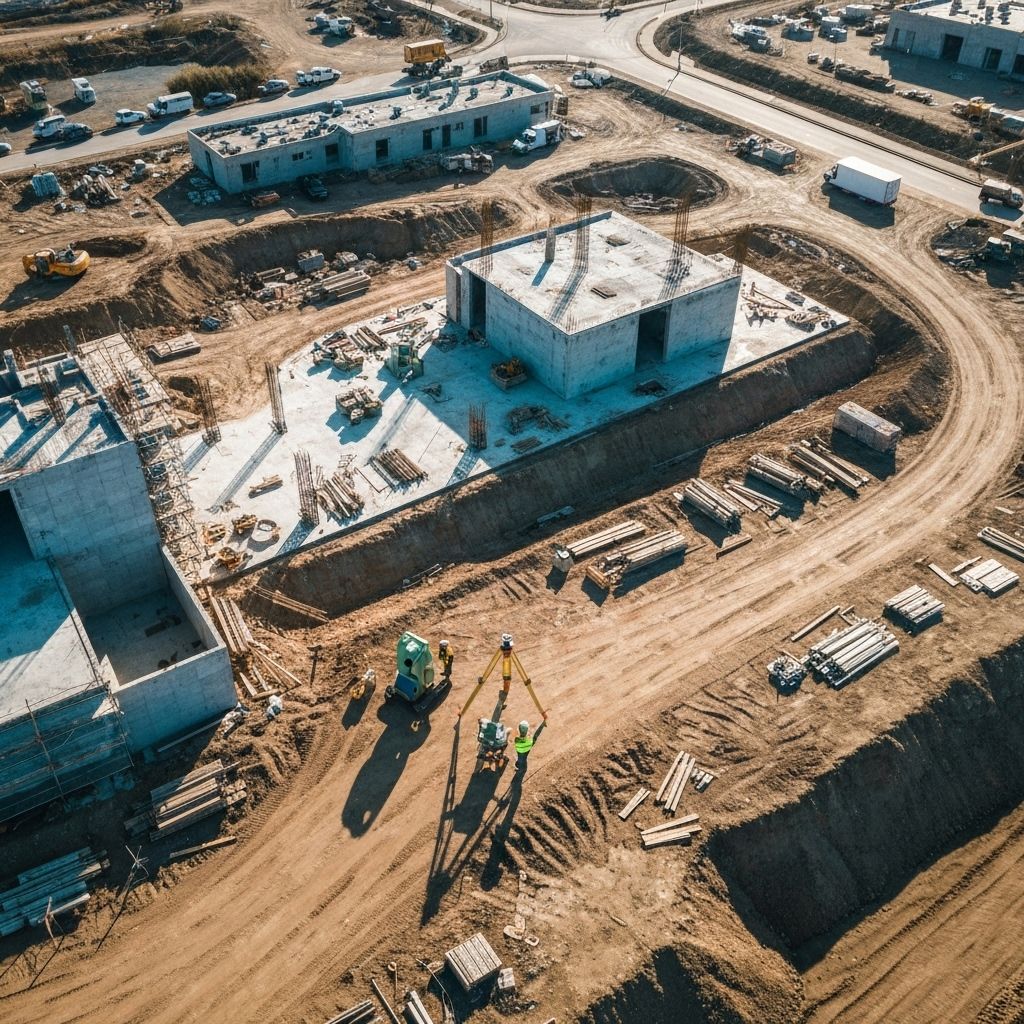
Precision Land Surveying for Modern Projects
Expert land surveying and consulting services powered by cutting-edge technology. Trusted by developers, architects, and engineers across the region.
99.9%
Accuracy Rate
500+
Projects Completed
25+
Years Experience

Comprehensive Land Surveying Services
From boundary surveys to complex development projects, we provide the precision and expertise your project demands.

Boundary/Lost Surveys
Precise property line determination using advanced GPS and laser technology for accurate boundary identification.
- Property line mapping
- Corner monumentation
- Legal descriptions
Topographical Surveys
Detailed elevation and terrain mapping for construction planning and site development projects.
- Contour mapping
- Elevation certificates
- 3D terrain modeling
A.L.T.A. / A.S.C.M. Land Title Surveys
Comprehensive commercial property surveys meeting ALTA/ACSM standards for real estate transactions.
- Title commitment review
- Easement identification
- Improvement location

Record of Surveys
Professional documentation and filing of survey records with local authorities.
- Legal compliance
- Record preparation
- Municipal filing

Corner Records
Precise corner establishment and monumentation for property identification.
- Corner establishment
- Monument setting
- Record documentation

Legal Descriptions and Exhibits
Detailed legal descriptions and exhibits for property transactions and development.
- Legal writing
- Exhibit preparation
- Boundary analysis

As-Built Surveys
Post-construction surveys documenting actual built conditions versus original plans.
- Construction verification
- Compliance documentation
- Final surveys

Civil Engineering Support Services
Comprehensive surveying support for civil engineering and development projects.
- Design support
- Construction layout
- Progress monitoring

FEMA Certifications
Flood zone determinations and elevation certificates for FEMA compliance.
- Flood zone analysis
- Elevation certificates
- FEMA compliance

Construction Staking
Professional staking and layout services to ensure construction projects meet exact specifications.
- Building staking
- Utility layout
- Grade verification
Our Process
We follow a systematic approach to ensure accuracy and efficiency in every project
Initial Consultation
We meet with you to understand your project requirements and objectives.
Site Assessment
Our team conducts thorough field work using state-of-the-art surveying equipment.
Data Analysis
We process and analyze all collected data with precision and attention to detail.
Final Deliverables
You receive comprehensive reports, maps, and documentation for your project.
Case Studies
Explore some of our recent successful projects across San Diego County
Residential Development
Comprehensive boundary and topographic survey for a 50-unit luxury residential development.
La Jolla, CA 2024
- 25-acre site
- Complex terrain
- Delivered ahead of schedule
Commercial Complex
ALTA survey and construction staking for a mixed-use commercial development.
Downtown San Diego, CA 2023
- Urban environment
- Multi-phase project
- Coordination with city planning
Infrastructure Project
Right-of-way mapping and utility location for municipal water system expansion.
Escondido, CA 2024
- Public works
- Utility coordination
- Environmental considerations

Who We Serve
We provide specialized surveying solutions for a diverse range of clients across San Diego County
Developers & Builders
Residential and commercial developers who need accurate surveys for planning, permitting, and construction.
Key Services:
- Boundary surveys
- Topographic mapping
- Construction staking
- ALTA surveys
Property Owners
Individual property owners seeking to understand their land boundaries, resolve disputes, or plan improvements.
Key Services:
- Property line surveys
- Easement location
- Fence line surveys
- Subdivision mapping

Architects & Engineers
Design professionals who require precise site data and surveying support for their projects.
Key Services:
- Site planning support
- Elevation certificates
- As-built surveys
- Utility location
Government & Municipalities
Public agencies needing surveying services for infrastructure, planning, and regulatory compliance.
Key Services:
- Right-of-way mapping
- Infrastructure surveys
- GIS mapping
- Regulatory compliance
Areas We Serve
Proudly serving all of San Diego County with comprehensive land surveying services
San Diego
- San Diego
- Chula Vista
- Oceanside
- Escondido
- Carlsbad
- El Cajon
- Vista
- San Marcos
- Encinitas
- National City
- La Mesa
- Santee
- Poway
- Coronado
- Imperial Beach
- Lemon Grove
- La Presa
- Solana Beach
What Our Clients Say
Don’t just take our word for it – hear from the professionals who trust us with their projects
Frequently Asked Questions
Get answers to common questions about our land surveying services
How long does a typical land survey take?
The timeline depends on the size and complexity of your property. A standard residential boundary survey typically takes 1-3 days for fieldwork and 3-5 business days for processing. Larger commercial projects may take 1-2 weeks. We’ll provide a detailed timeline during your consultation.
What's the difference between a boundary survey and a topographic survey?
A boundary survey determines the exact property lines and corners of your land, while a topographic survey maps the elevation changes, natural features, and existing structures on the property. Many projects require both types of surveys for complete site information.
Do I need a survey if I'm just building a fence?
Yes, we highly recommend a boundary survey before installing a fence. This ensures your fence is placed correctly on your property and helps avoid costly disputes with neighbors. Many municipalities also require surveys for fence permits.
What should I do to prepare for a survey?
Clear any vegetation or obstacles near property corners if possible, locate any existing survey markers or pins, and ensure our team has access to all areas of the property. We’ll provide specific preparation instructions based on your project type.
How much does a land survey cost?
Survey costs vary based on property size, terrain complexity, research requirements, and survey type. We provide free estimates and will discuss all factors affecting the price during your consultation. Contact us for a personalized quote.
Are your surveyors licensed in California?
Yes, all our surveyors are licensed Professional Land Surveyors (PLS) in the state of California. We maintain current licenses and continuing education to ensure we meet all state requirements and industry standards.
What happens if there's a property line dispute?
We can provide expert surveying services to help resolve property disputes. Our detailed surveys and professional testimony can be used in legal proceedings. We work with attorneys and property owners to provide clear, accurate boundary determinations.
Do you provide digital copies of survey documents?
Yes, we provide both physical and digital copies of all survey documents. Digital files are delivered in PDF format and can include CAD files when requested. This makes it easy to share with contractors, architects, and other professionals.
Trusted Expertise Since 1998
For over 25 years, Anderson Land Surveying & Consulting has been the trusted partner for property developers, architects, engineers, and property owners throughout the region. Our commitment to precision, innovation, and client satisfaction sets us apart.
Expert Team
Licensed professionals with decades of combined experience
Fast Turnaround
Efficient project delivery without compromising quality
Fully Insured
Complete professional liability and general insurance coverage
Quality Assured
Rigorous quality control and accuracy verification processes
Why Choose Anderson Land Surveying?
- State-of-the-art GPS and laser scanning technology
- Licensed professional surveyors in multiple states
- Comprehensive project management from start to finish
- Competitive pricing with transparent cost estimates
- Exceptional customer service and communication
Ready to Get Started
Contact us today for a free consultation and project estimate.
(555) 123-4567
info@andersonlandsurvey.com
Get Your Project Started Today
Ready to move forward with your land surveying needs? Contact our expert team for a free consultation and detailed project estimate.
Contact Information
(619) 558-5030
Main Office
info@andersonlandusveying.com
General Inquiries
123 Survey Street
Suite 100
Business Hours
Monday – Friday: 8:00 AM – 6:00 PM
Saturday: 9:00 AM – 3:00 PM
Sunday: Closed
Emergency services available 24/7 for urgent projects