
Our Process
At Anderson Land Surveying & Consulting, we believe a successful survey begins with clear communication and ends with results you can trust.
That’s why we follow a proven, step-by-step process designed to deliver accuracy, efficiency, and peace of mind.
Step 1: Consultation & Project Review
Every project begins with a conversation. We’ll review your needs, goals, and property details to determine the type of survey required. Whether it’s a boundary survey for a fence or an ALTA survey for a commercial transaction, we tailor our approach to your project.
Step 2: Research & Records Review
Our team conducts a thorough review of deeds, plats, easements, and historical survey data. This background research ensures we understand the property’s legal history before fieldwork begins.
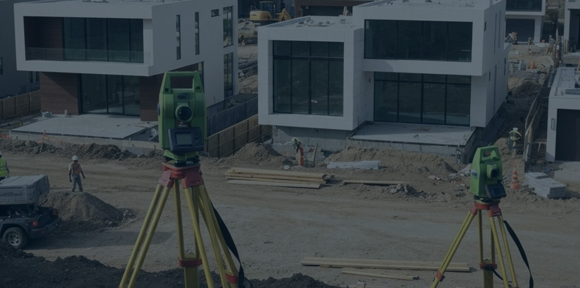
Step 3: Field Measurements
Using advanced GPS, total stations, and laser scanning technology, our licensed surveyors visit the site to collect precise data. We locate existing monuments, measure boundaries, map features, and gather elevation information as needed.
Step 4: Data Analysis & Boundary Resolution
Back in the office, we process field data and compare it with historical and legal records. This step allows us to accurately define property boundaries, verify elevations, and ensure compliance with local, state, and federal standards.
Step 5: Mapping & Documentation
We prepare detailed maps, plats, legal descriptions, and exhibits tailored to your needs. Deliverables are provided in clear, easy-to-understand formats — from CAD and GIS files for engineers to certified plats for homeowners and title companies.
Step 6: Client Review & Delivery
Once the survey is complete, we walk you through the findings, answer questions, and provide certified documentation. Our goal is to ensure you fully understand your results and feel confident moving forward.
Why Our Process Works
- Accuracy First – Each step is designed to minimize errors and deliver legally defensible results.
- Transparent Communication – We keep you informed from start to finish.
- Tailored Solutions – No two projects are the same; our process adapts to your specific needs.
- On-Time Delivery – Our workflow ensures efficiency without compromising quality.
The Anderson Advantage

Licensed & Experienced Professionals
Our surveys are conducted by licensed, insured professionals with decades of combined expertise. We know the laws, regulations, and standards that protect your property rights.

Unmatched Accuracy
We use advanced GPS, laser scanning, CAD, and GIS technology to ensure results with industry-leading precision. Fewer errors mean fewer costly problems for you down the road.

Local Knowledge & Compliance
From zoning codes to county filing requirements, we understand the local rules and regulations — and make sure your survey is fully compliant every time.

Clear Communication
We don’t just hand over complex data — we explain it. Our team provides clear reports, easy-to-read maps, and takes the time to answer your questions.

Full-Service Capabilities
From boundary surveys and FEMA certifications to construction staking and ALTA surveys, we offer a complete range of services under one roof. No matter your project, we’ve got you covered.

Timely, Reliable Delivery
We respect your deadlines. Our team works efficiently to deliver accurate results on schedule, helping you keep projects on time and on budget.
Get Started Today
Whether you’re preparing for construction, resolving a boundary question, or purchasing property, our process ensures you get the answers you need.
Contact Anderson Land Surveying & Consulting today to start your project with confidence.